The explorer who will not come back or send ships to tell his tale is not an explorer, only an adventurer, and his sons are born in exile.
—Ursula K. Le Guin, The Dispossessed (1974)
He died in exile: as with all men, it was his lot to live in bad times.
—Jorge Luis Borges, “A New Refutation of Time” (1944-1946)
In 1776, Pierre L’Enfant is an art student at the Royal Academy of France, studying under his father, a prominent painter of battle panoramas. The next year, he enlists as a volunteer in the American Continental Army, arriving on a ship carrying ammunition for the insurgent forces.1 Upon arriving in America, he begins going by Peter. At Valley Forge that winter, L'Enfant endears himself to his fellow officers by drawing their likenesses, including that of George Washington, who referred to L'Enfant, whether out of affection or ignorance, as "Monsieur Lanfang."2 He wins the general’s respect by being injured and then taken prisoner, at Savannah and Charleston, respectively.
In the years following the war, L'Enfant becomes a factotum for hire in the new nation, tasked with design projects—a government building, a banquet hall, pins for a fraternal order—that often run well over budget.3 In 1791, on Washington’s personal recommendation, he is given a commission to plan the new federal city, to be situated in the crotch of the Potomac and Anacostia Rivers, a parcel of land Washington has admired from horseback on rides around his Virginia estate.4 A diamond-shaped slice of 100 square miles is ceded by Virginia and Maryland. Into the center of that diamond, L'Enfant scores a grid of irregular, syncopated streets and grand avenues radiating out from roundabouts and rectangular plazas. Remembering the golden ratio from his art school days,5 L’Enfant orients his designs around and in relation to a large right triangle, with the President's House and Congress connected by its hypotenuse and an equestrian statue of General Washington proposed for the correlating point. The Congress house is marked as longitude 0° 00’, indicating a prime meridian. The same map includes a “historic column," a mile east of Congress, from whose location, L’Enfant instructs, "all distances of places through the Continent, are to be calculated."6 The confusion between these two zero points is never elucidated.
In 1792, after destroying the home of a prominent landowner in service of his street scheme, the profligate perfectionist is relieved of his duties.7 Andrew Ellicott, who has been working under him, is deputized to revise the plans and continue the survey accordingly. Under celestial observation, Ellicott draws true east-west and north-south lines, meeting at the site intended for the Capitol building.8 The longitude is the first of what will come to be known as the Washington meridians, lines from which all other distances in the expanding nation will be measured, and from which time will eventually be told.
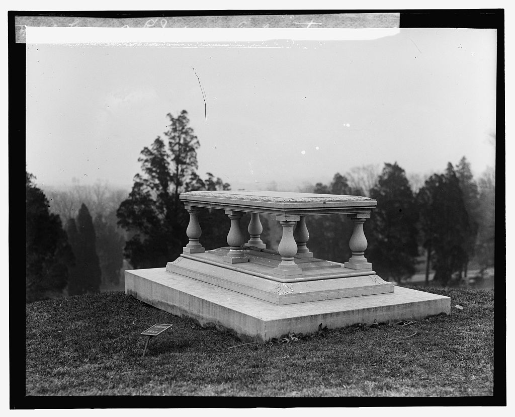
Upon L’Enfant’s death in 1825, his only worldly possessions will be three watches, three compasses, some books, some maps, and surveying equipment, together worth $46.9 Grave of L’Enfant, Arlington, Virginia. 1926/27. Source: https://www.loc.gov/resource/npcc.16396. Image provided by the author.
In the time of the ancient Greeks, it is common practice for each mapmaker to draw an arbitrary line of reference, suitable for the task at hand. Alexandria, Rhodes, and the Canary Islands serve as early meridian markers. In later centuries, nations begin to establish their own prime meridians, often through the center of their national observatories, wherever they might be: Paris, Naples, Lisbon, Greenwich, Rome, Madrid, Cádiz, Copenhagen, Amsterdam, Rio de Janeiro, Christiana, Pulkovo . . .10
Previously, American mapmakers have often measured distances on the continent from both London and Philadelphia. New York's City Hall (not the one L’Enfant had redesigned, but the one that had replaced it) is also sometimes cited, and perhaps the very first American meridian had been drawn through Boston, though it was never in wide use.11 Likewise, the Capitol Building meridian is seldom employed for mapmaking. In an 1801 letter from Ellicott to President Thomas Jefferson, the surveyor writes, "I have long been wanting our longitude to be reckoned or counted from our own capitol and not from a point within any other nation. . . . We appear yet to be connected to Great Britain by a small number of ligaments . . . "12
In 1804, Jefferson endeavors to cut one of these ligaments, though he has in mind a slightly different coordinate than the line that has already been drawn. Standing on the doorstep of the White House, using a transit, an oil lamp, and a prepared tin cylinder, the surveyor Nicholas King determines a new meridian, to run directly through the President's Palace and to be marked at a point found atop a hill two miles north.13 With the permission of the tobacco magnate who owns the land, a small obelisk of freestone is placed there, the Meridian Stone, on what will come to be known as Meridian Hill. Two more markers are placed along the same line, closer to the White House: another obelisk called the Capitol Stone and a small pier called the Jefferson Stone.14 So, three stones come to demarcate a single, imaginary line, running through the White House and to the north and south poles at either end of the globe, a line from which all others should be measured. Despite Jefferson’s wishes for the world to begin at his doorstep, his line, like the one that had come before it, is promptly forgotten. The Jefferson Stone comes to be used instead as a guidepost for barges traveling the Tiber Creek channel of Washington's canal network.15
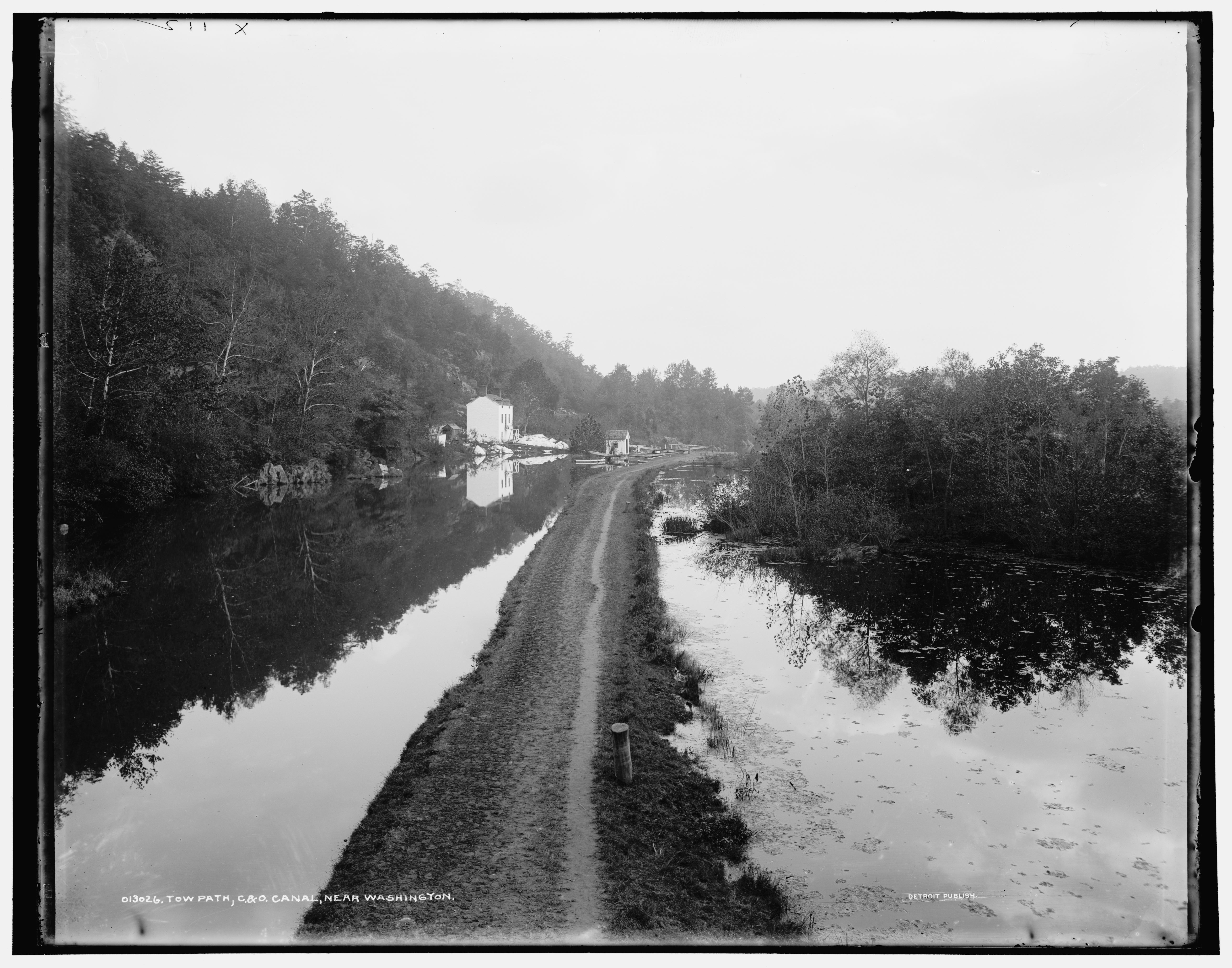
A stone is found more useful as object than symbol. Tow path, C & O Canal, Near Washington, c. 1900. Source: https://www.loc.gov/item/2016808376/. Image provided by the author.
Still, the nineteenth century will be marked by American expansionism not only in space, but also in time. National identities—not one, but many—will be forged to the ticking sound of American-made interchangeable parts, from the “master’s clock” in the Southern plantation, organizing the horrors of chattel slavery, to the clocks set into the church steeples of quaint New England towns, themselves part of an aesthetic program promoting regional identity and racial supremacism.16 In one such town, Concord, Massachusetts, Ralph Waldo Emerson is a congregant of one such church. In 1840, his group, the Transcendental Club, is fomenting the first homegrown artistic and philosophical movement of American settlers, based around the primacy of individualism and spiritual experience accessible only through nature. In the pages of The Dial, named after that earlier keeper of time, they look back to geological “deep time” and forward to a more liberated future: twin frontiers for the expansion of the American mind.
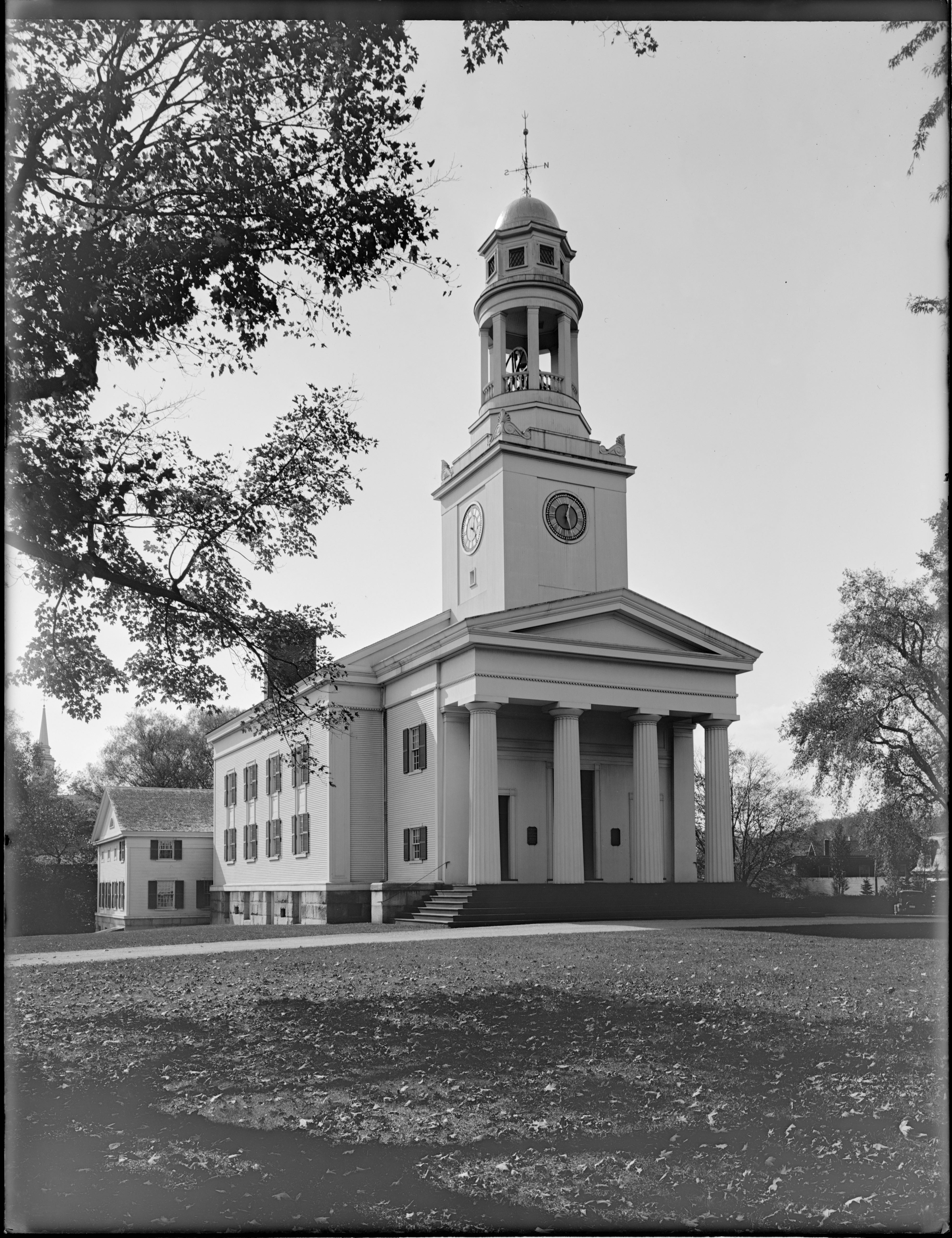
The funeral services for both Ralph Waldo Emerson and Henry David Thoreau were conducted in this hall.17 Unitarian Church, Concord, Massachusetts, 1929. Source: https://www.digitalcommonwealth.org/search/commonwealth:f7623j66r. Image provided by the author.
***
“Do you have the time?” No, I don't have the time. I use a little of it, like everyone, but I don't have it. I think— I think the Navy has it, in Washington. They keep it in the Observatory. That's right. Sure, they let out a little of it each day. Not too much. They wouldn't want to give us too much.
—George Carlin, Again!
In 1850, after many years of resisting the imposition of centralized standards for time and space, Congress finally recognizes a national prime meridian. It runs through neither the Capitol Building nor the White House, but through the center of the dome of the Naval Observatory at 23rd and E Streets.18 The law instructs that this new Washington meridian should be used for "all astronomical purposes," meaning measurements of land, and the Greenwich meridian, which has remained the shipping and business standard, maintained for "all nautical purposes."19 This is the Washington meridian from which the borders of many western states will be drawn, albeit inexactly. Boundaries that had once been defined by rivers and natural features became fine-lined abstractions, contributing to the boxy, coarse-grained look of the midwest on our maps.20
In 1877, work on the Washington Monument resumes, after a 23-year hiatus comprising the Civil War and a power struggle for control of the monument, during which time the stump sat unfinished in approximately the spot where L’Enfant’s equestrian statue was meant to go. Engineers check the settlement elevations of the monument against the nearby Jefferson Stone, which had previously been used as a benchmark, and find that their construction had sunk 8 inches into the earth, an alarming rate even on a riverbank.21 It is eventually discovered that the Capitol Stone had been mistaken for the Jefferson Stone, accounting for the discrepancy, and that the latter had been broken up and carried away during a 1872 renewal project by the Army Corps of Engineers.22 Two miles north, the Meridian Stone had met a similar fate in order to accommodate the extension of 16th Street, N.W.
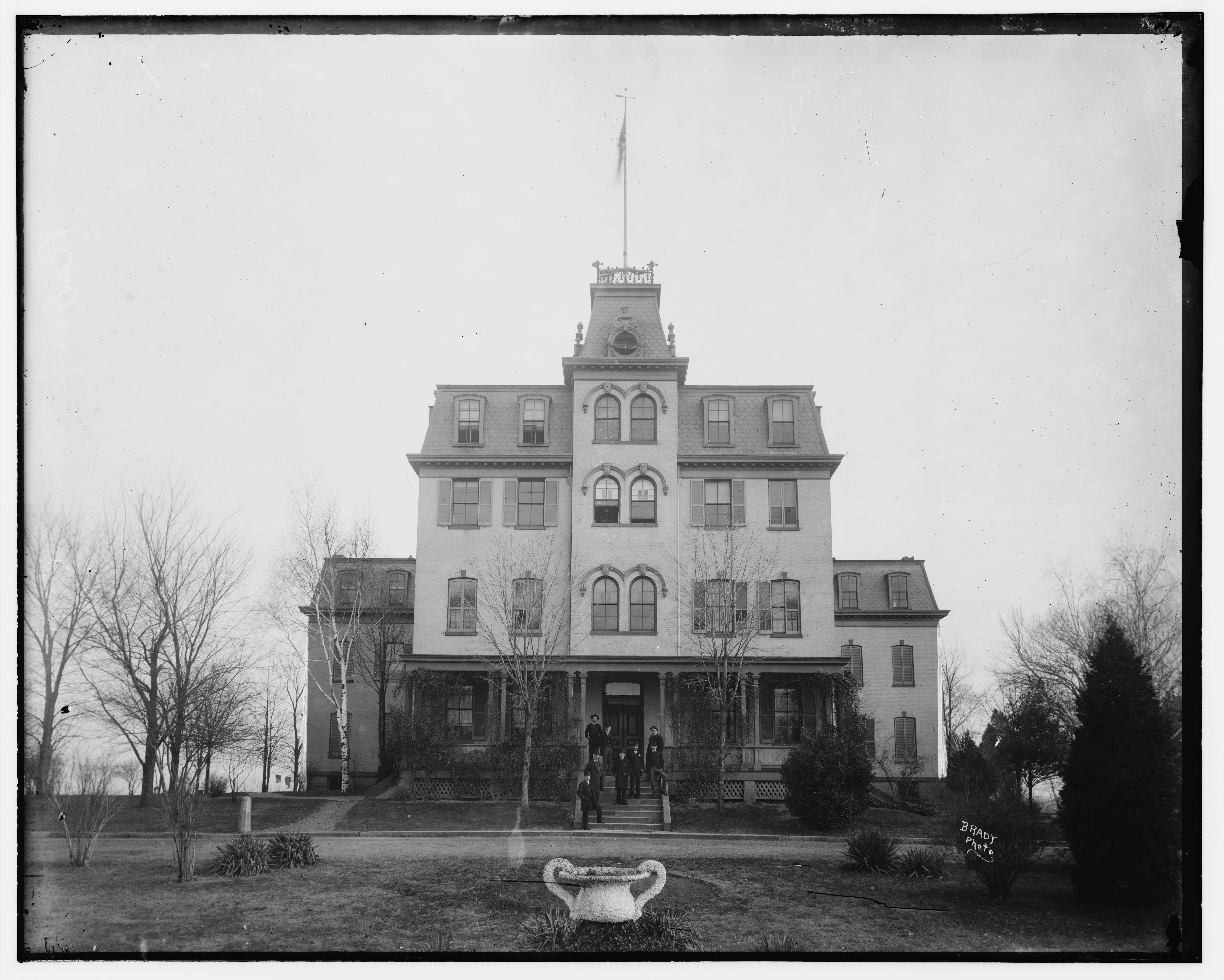
After having been dumped on a rubbish heap, the Meridian Stone was apparently mutilated by a stone mason, and then used as a hitching post at a reform school where a 16-year-old Charles Manson would later be enrolled.[ref] Geyer, Washington History, 86 & Matthew Brady, “Reform School. Bladensburg Rd., Wash. D.C.,” Getty Images. https://www.gettyimages.ae/detail/news-photo/view-reform-school-bladensburg-rd-wash-d-c-between-1860-and-news-photo/1410608746[/ref] Reform School on Bladensburg Road, Washington, DC. Photo by Matthew Brady. Source: https://www.loc.gov/item/2017897845/. Image provided by the author.
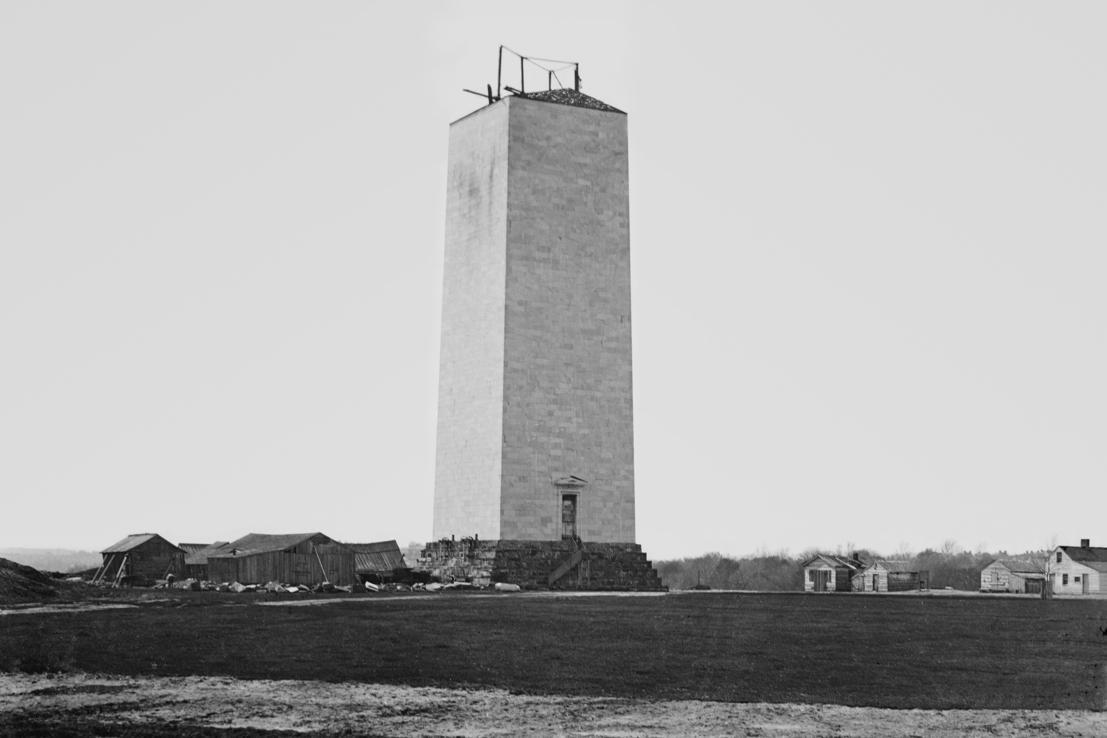
The materials whose mass and permanence fortified the operations of space and time were themselves found to be perversely insecure. Washington Monument during construction hiatus, 1860. Source: https://www.defense.gov/Multimedia/Photos/igphoto/2002290372/. Image provided by the author.
***
The International Date Line lies motionless between Samoa and Tonga, but the Midnight Line slips forward over the ocean, over the islands and the hutroofs. On the other side they are asleep now. Here in Värmland it is noon, a hot day in late spring . . . I’ve thrown away my luggage.
—Tomas Tranströmer, “For Mats and Laila” (1978)
In 1883, a system of time zones is adopted by the American railroad industry as an efficiency measure. Charles F. Dowd, the schoolteacher who had first proposed the zones, originally oriented them to the Washington meridian. It will take until the Standard Time Act of 1918 for the federal government to adopt time zones, by which point the route mileage of American railroad tracks will have begun to decline with each passing year, facing competition from the automobile.23 Dowd himself will be long dead by then, having been struck by a train in 1904, in the course of his evening walk.24
In 1884, representatives from 26 nations convene to establish a global meridian from which to base a standard clock.25 At previous conferences in Venice (1881) and Rome (1883), the argument had been made in favor of Greenwich, on the basis that 72% of sea-bound tonnage is already being charted in relation to that London burb.26 The Greenwich meridian also has the advantage that its opposite, which is to be the International Date Line, runs through mostly unpopulated waters in the middle of the Pacific, just as the ancient Romans had provided for one day to end and another to begin in the middle of the night,27 such that only somnambulists and swing shifters could be accused of illicit travel in time. If the Washington meridian is selected by the conference as the international standard, the date will have a land border running through Russia, Mongolia, Thailand, and Malaysia. After three weeks of debate, the Greenwich Meridian is voted the global standard. France, rebuffed, maintains its own Paris meridian until 1898, at which time they concede to set their clocks to "Paris mean time, retarded by nine minutes twenty-one seconds."28
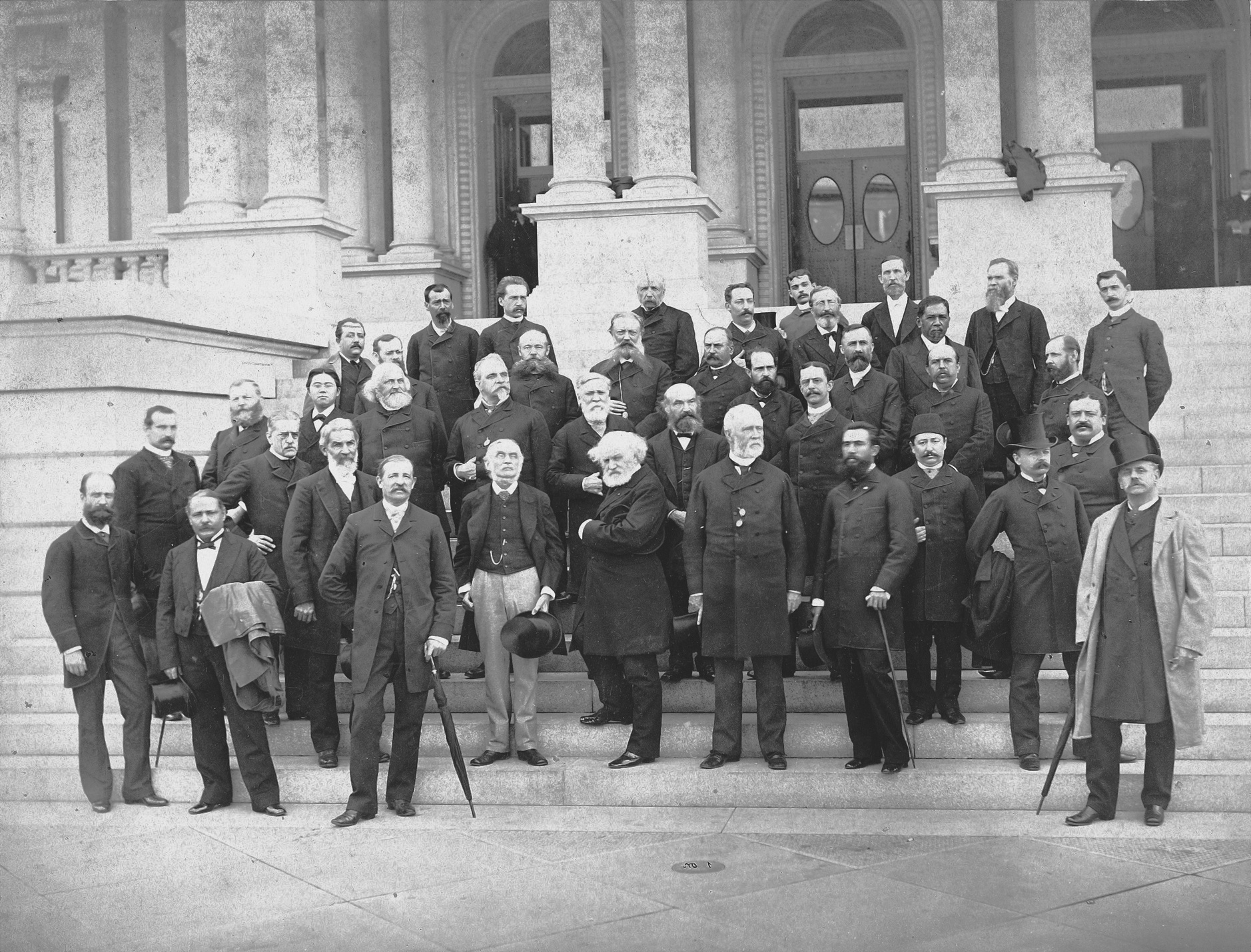
Time itself changes to keep pace with transportation and trade in a mechanizing world, which is not to mention modern military mobilizations. Just as railroad companies and shipping lines lobbied governments to adopt standard time, so did defense officials.29 Delegates to the International Meridian Conference on the steps of the State-War-Navy Building, 1884. Source: https://www.history.navy.mil/our-collections/photography/numerical-list-of-images/nhhc-series/nh-series/NH-96000/NH-96688.html. Image provided by the author.
In 1889, it becomes imperative to reestablish the location of the Jefferson Stone, in order to settle property disputes along the Potomac Flats, where Virginia ends and Washington begins, parcels in whose drawing up the stone had been used as a reference.30 The new marker, installed by the Army Corps of Engineers, who had inadvertently destroyed the previous one, now reads:
POSITION OF JEFFERSON
PIER ERECTED DEC. 18, 1804
RECOVERED AND RE-ERECTED
DEC. 2, 1889
BEING THE CENTRE POINT OF THE
DISTRICT OF COLUMBIA
The struck-through section is completely removed by a stone mason's chisel. It had been engraved there in error, as the meridian marked by the Jefferson Stone was never intended to run through the center of the city. An additional marker, a 17-inch square of granite, is placed within the Ellipse south of the White House.31 It is engraved:
U.S.
MERIDIAN
1890
In 1893, the Naval Observatory moves to a new facility just north of Georgetown, and the American meridian moves with it, running through its clockroom, gracing the odd map, but by now almost entirely defunct.
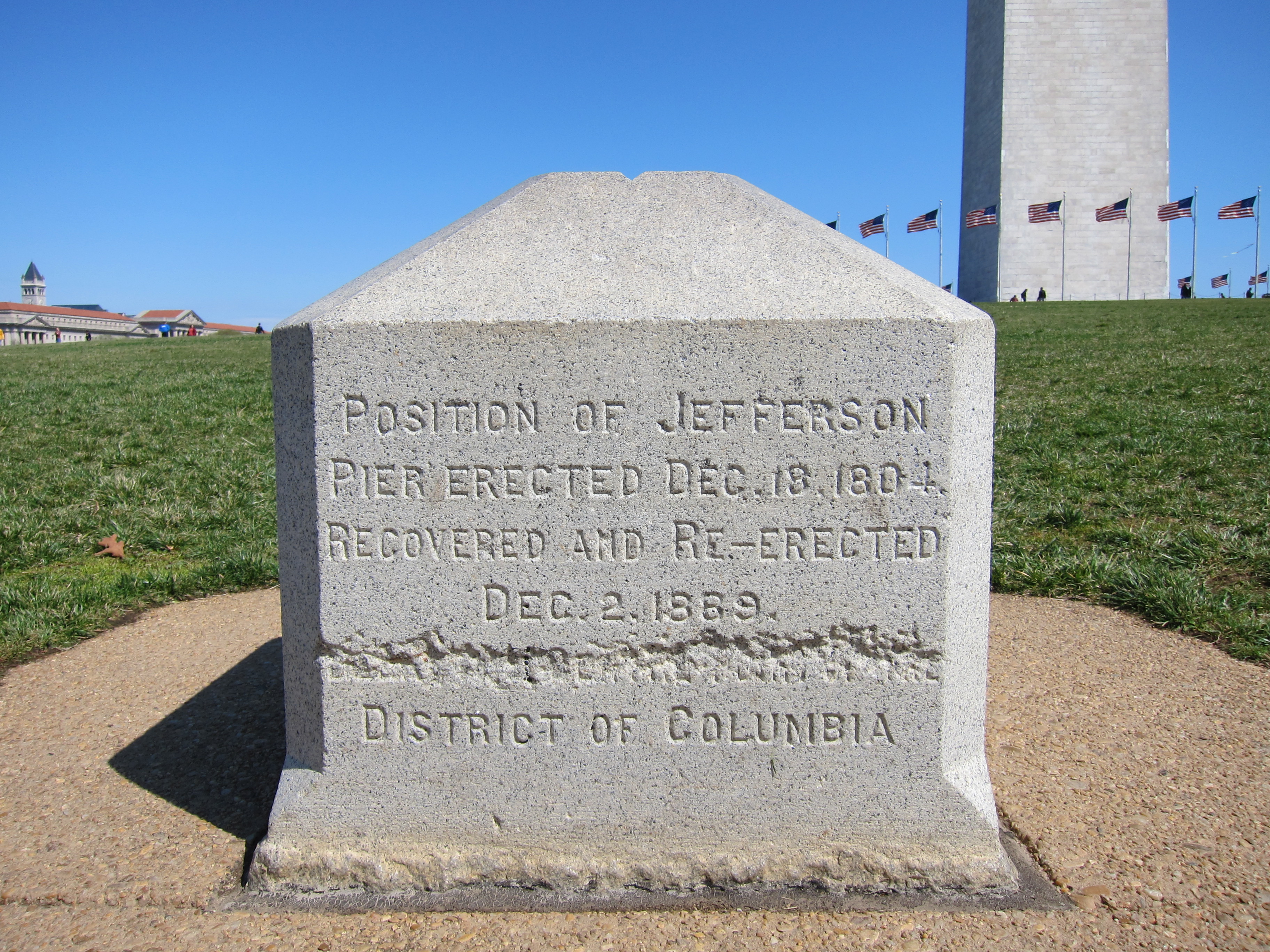
The Jefferson Stone on the National Mall. Photo by Something Original. Image provided by the author.
***
The roads are straight, the distance between towns long.
The sky is making a new proposition to the earth.
—John Berger, “On the Polish Rider” (2006)
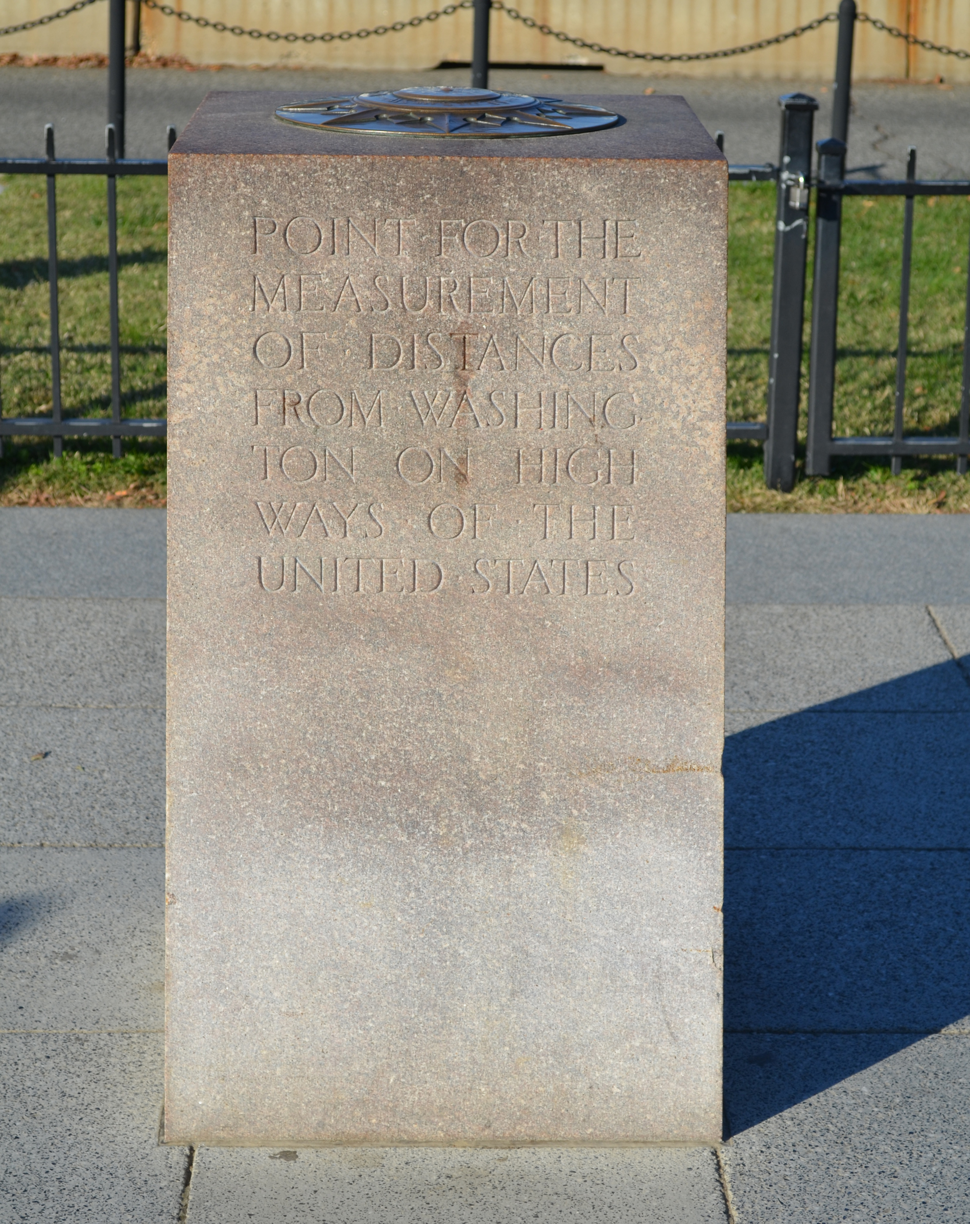
In 1923, the Zero Milestone is placed on the Mall, mistakenly set 1 foot west of the White House meridian. Inspired by the Milliarium Aureum of Ancient Rome, it is intended as the starting point for the distances of all highways in the United States, as was the "historic column" L'Enfant had planned, but which was never built. In fact, only roads within the city will ever be marked from this site.32
Dr. S. M. Johnson, an advocate of the Good Roads Movement, has proposed the monument and received permission to install it, provided it can be accomplished at no cost to the government. Its benefactors include General Motors, the co-founder of Goodyear Tires, and the American Automobile Association (AAA). Made of Milford granite and inlaid with a bronze compass rose on top, the waist-high monument is engraved on its south side:
POINT FOR THE
MEASUREMENT
OF DISTANCES
FROM WASHING-
TON ON HIGH
WAYS OF THE
UNITED STATES
In his address to the thousands gathered for the stone's unveiling, Johnson says, "We have taken our stand for a paved United States. . . . The use of the automobile is universal, therefore pavement must be universal. Until this is accomplished, we will not be living in the spirit of the age in which our lives are cast.”33
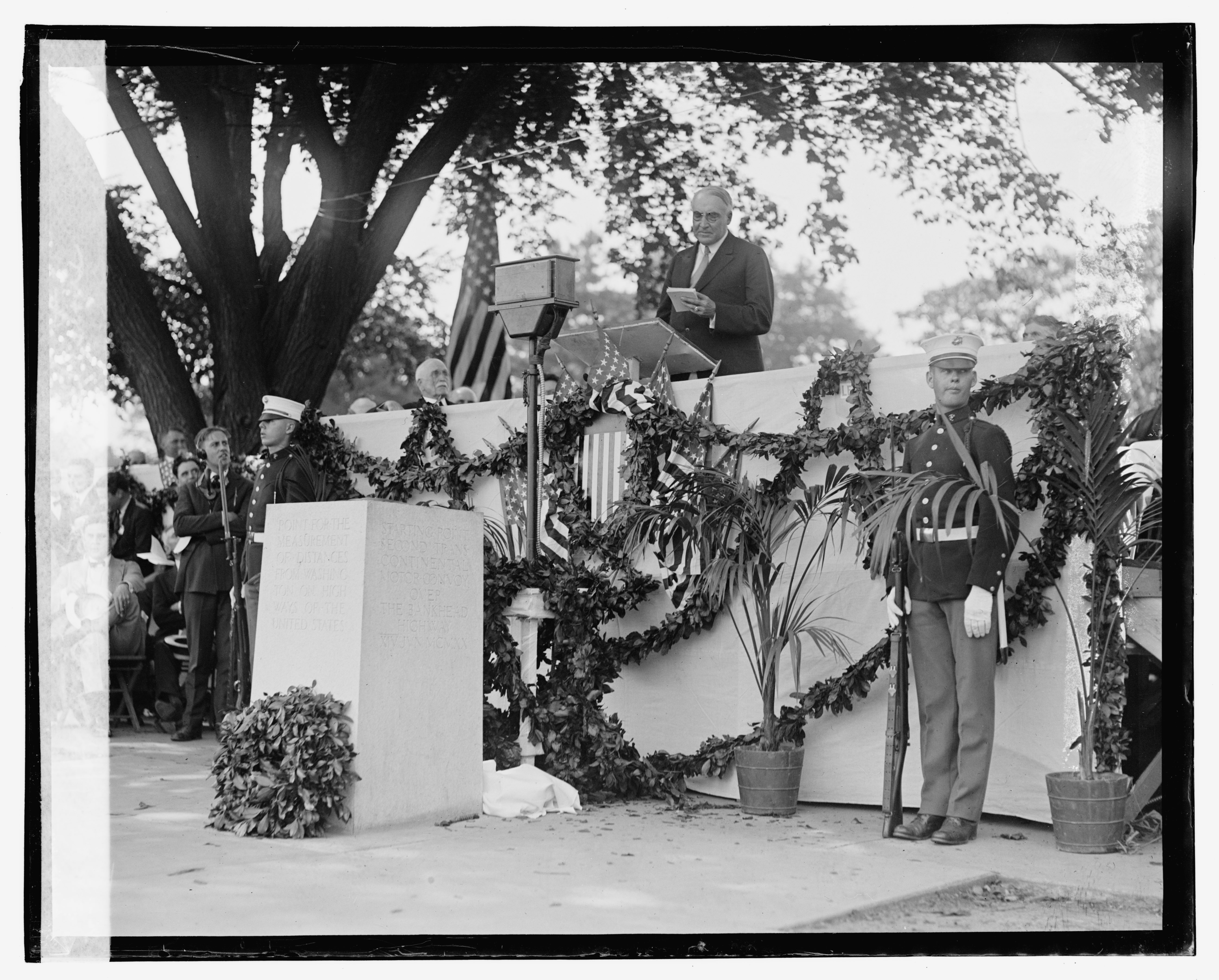
The Good Roads Movement had originated as a coalition between farmers and bicyclists. President Warren G. Harding speaks at the unveiling of the Zero Milestone, 1923. Source: https://www.loc.gov/resource/npcc.08756/. Image provided by the author.
Dwight Eisenhower was a junior officer in the transcontinental motor convoy. As President, he would endorse the nation’s new Interstate Highway System. Source: Zero Milestone. Photo by Tim Evanson. Image provided by the author.
***
Spent so much time living in disbelief, living like a fugitive on time you thought you stole. …
On this dark morning, it will occur to you that perhaps time is not a weapon, but a thickness of fabrics, some layers gauzy and porous, others a maze of brocade and knit.
—Ras Mashramani, “A Prayer for Catatonia” (2021)
In April 2022, the Philadelphia-based collective Black Quantum Futurism presents a Prime Meridian Unconference in New York City, under the aegis of the Vera List Center for Art and Politics. It is billed as “a space-time for rewriting the protocols of time, rezoning the time zones, and unmapping the imperialist global time colonization project.”34 Departing from the 1884 conference in Washington, its collaborators invoke “Colored People’s Time,” reclaiming a racist trope to facilitate “Black temporal agency, temporal and spatial reparations, and spatial liberation.” Black people in this country remain segregated not only in space, but in time, denied access to past, present, and future. In the course of the Unconference, participants developed a new set of provisional protocols with which travel through time may be amended and more equitably distributed, drawing on Afrodiasporan temporal technologies and quantum theory.35
There is something terrifying and perversely endearing about the clumsiness of a young nation's will to order and expansion, the error-prone feeling for world-making that accompanied the genocidal logics of manifest destiny. The stalwarts of the young American nation conceived of their project as a tabula rasa and a Year Zero, extending their ambitions not only across the breadth of the continent, but also into its history and its future. They endeavored to set their watches and chart their maps by its federal city, but only for a short time. Globalizing networks of migration and trade, invasion and enslavement, had provided for the nation’s bloody birth and unlovely pubescence. Soon they would overtake the flimsiest of its pretensions: that the U.S. could be a world apart from the one its settlers had left behind. Still, when standardization came to the clocktowers and the timetables, it came on the nation’s own terms, the agreement ratified in the city where monuments and markers still proudly claim another way, oddly provincial in their peculiarity.
Today, the Milestone is put to use by tourists who rest their coats and bags atop it in order to pose for pictures in front of the White House. The Jefferson Stone is as much a tripping hazard as it ever was for those stepping back to take in the Washington Monument. The 1890 marker is worn and partly grown over with grass. The old stones are still somewhere, too, no longer marking a mule’s towpath or hitching a policeman’s horse outside a reform school. More than ever, they mean nothing in particular, or their significance has been returned to the realm of geology. The Department of Transportation is responsible for ensuring that all U.S. towns and cities adhere to uniform, standard clock. They encourage those aware of a municipality failing to observe the proper time to report the violation.36