Monuments, like maps, are powerful in the way that they modulate the logistics of space, typically defining what is included and excluded—both theoretically and spatially. While constructed under the pretext of national security, the functional and statistical reality concedes that this is nothing more than symbolic gesture—a means of the U.S. flexing its militarism and spending its hefty security budget A grand monument of division, the U.S.-MX border wall spans approximately 700 miles from sister-cities San Diego / Tijuana to Matamoros / Brownsville. And while the current discourse makes it seductive to focus on the tragedy of the wall itself, I want this project to look outwards, towards the broader spatial conditions negotiated by it. The wall itself has become the edifice for a political agenda, a tool to militarize the minds of many and by focusing on the monument will only lead to more distractions. The border has evolved far past boundary markers, fences and walls, they have stretched across the landscape in the form of national parks, military bases, parking lots, malls and federally protected land. The tension between territorial lines and the landscape, water and culture that move across them generate a specific type of urbanism, a border urbanism.
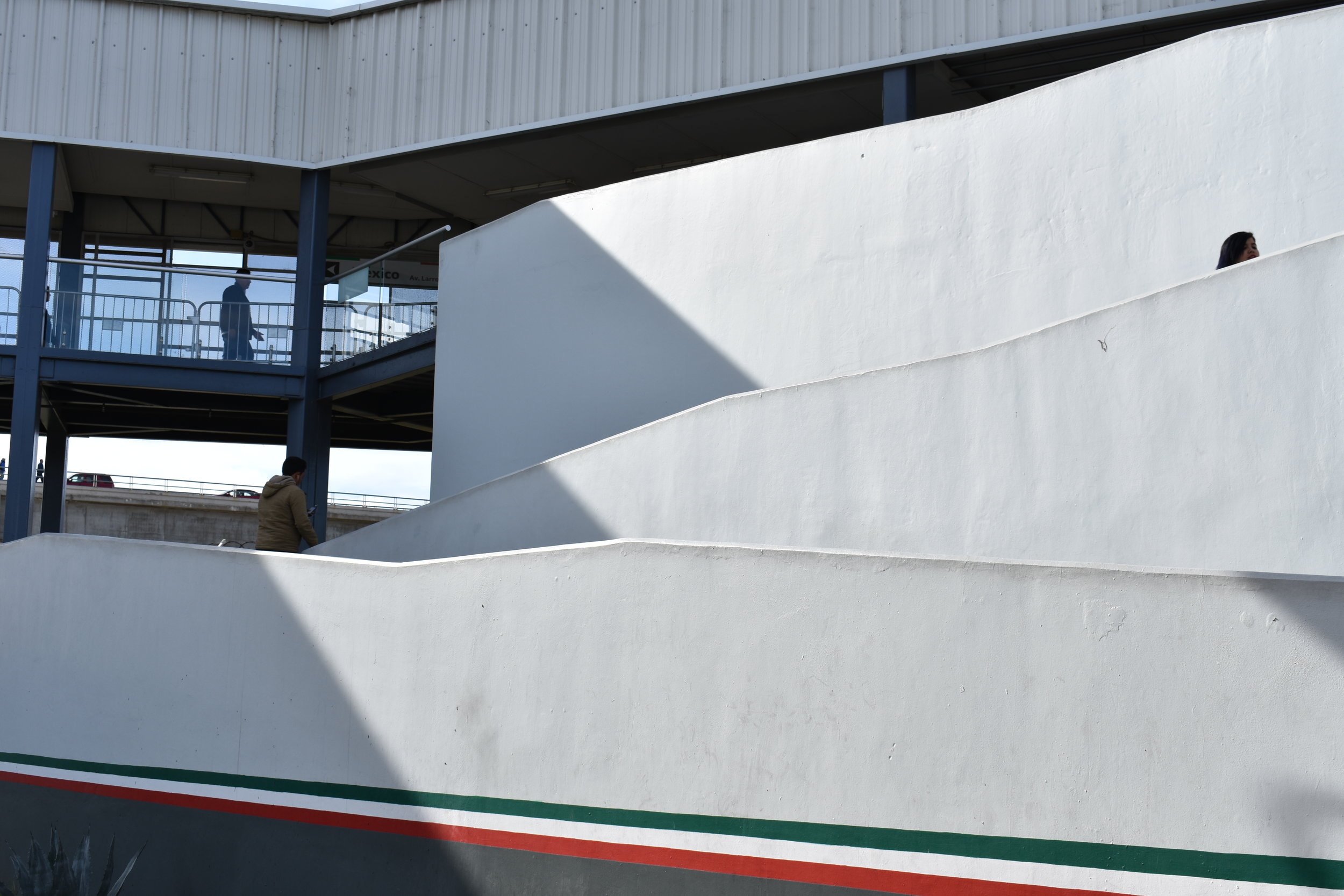
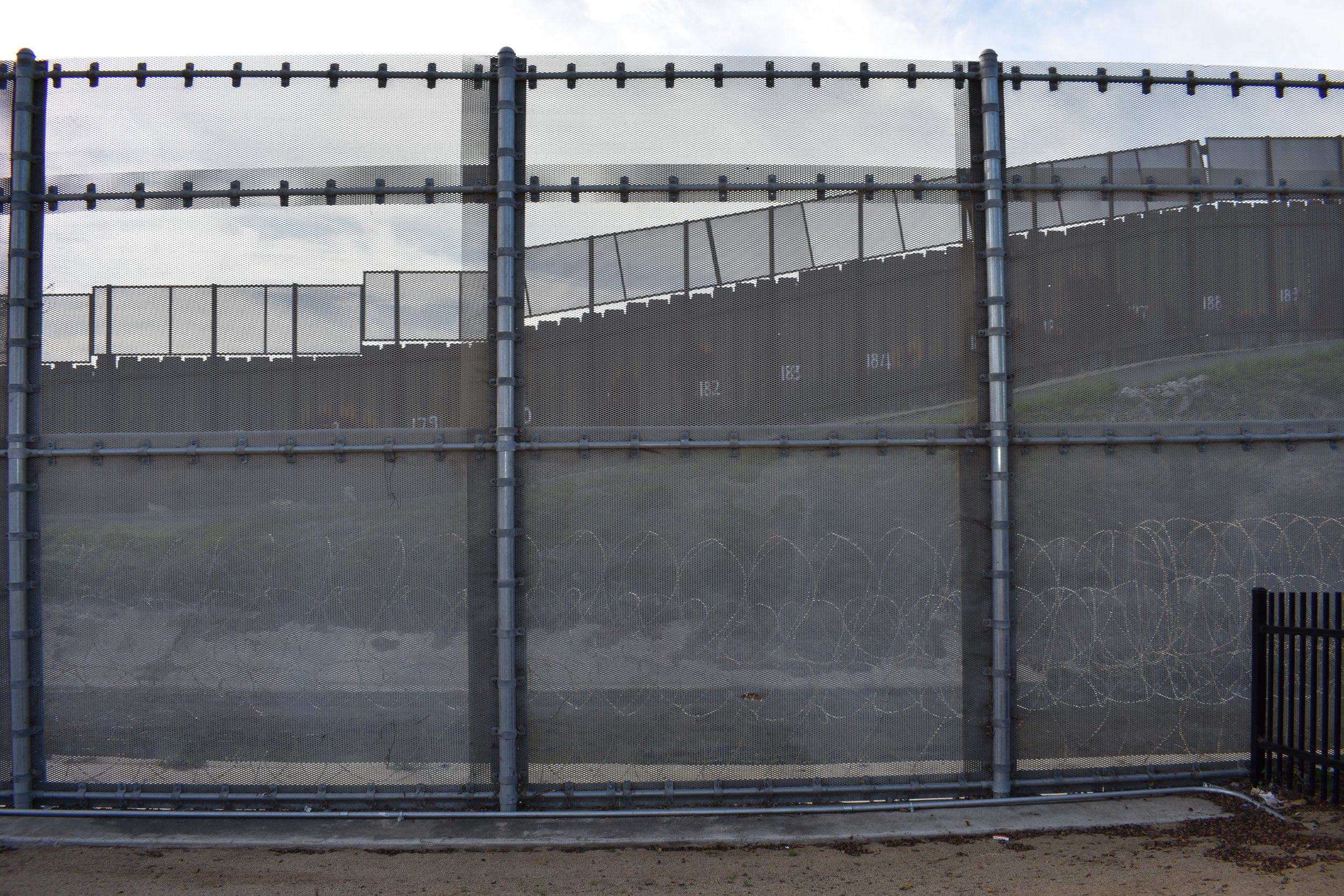
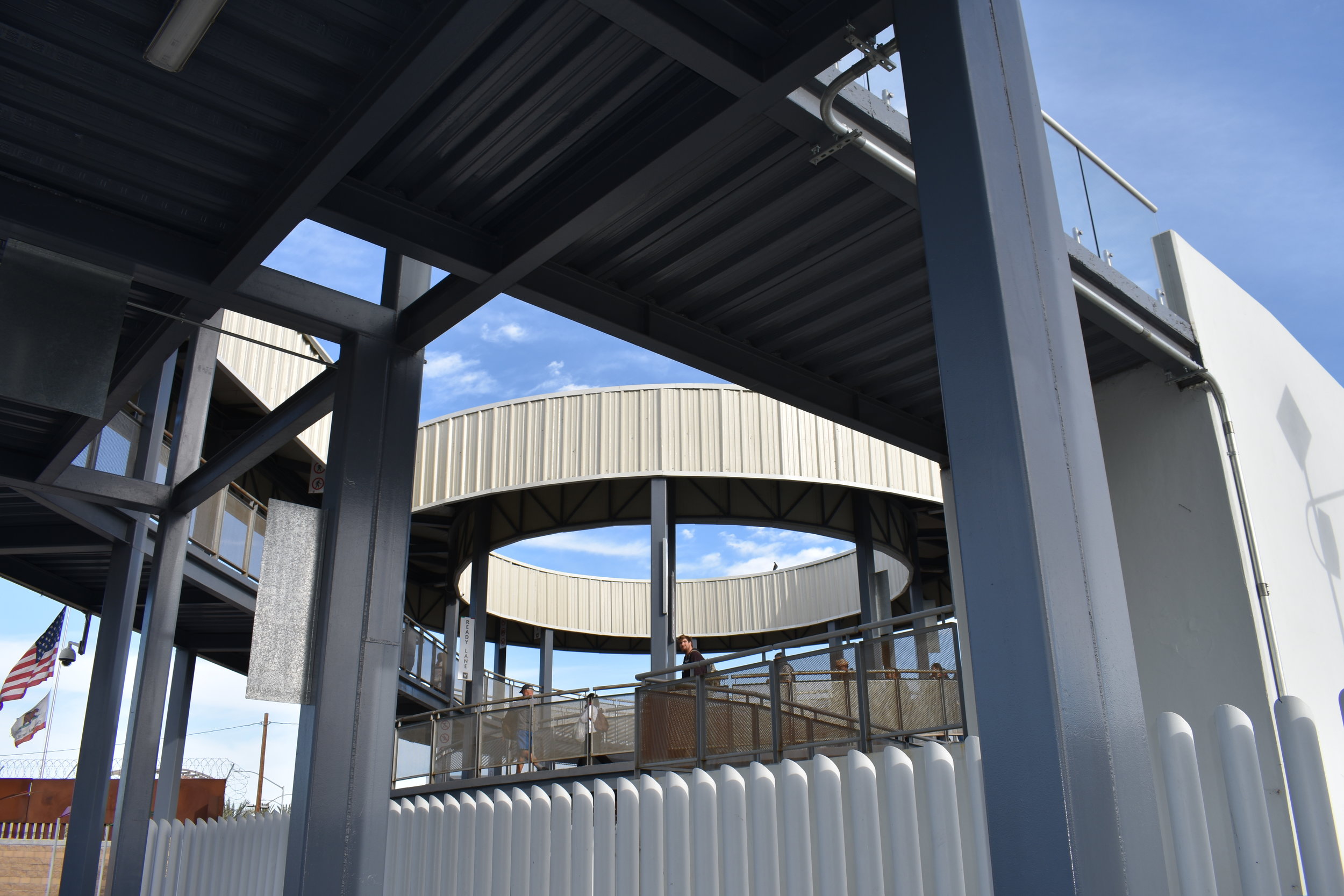
The San Ysidro ‘PedWest’ Port of Entry is a fascinating case study to border as urbanism. If you start at San Diego’s Virginia Avenue Transit Center and proceed south towards the newest pedestrian entry, San Diego’s infamous ‘Triple Fence’ quickly becomes visible. A symbol for border excellence, the Triple Fence has three layers of 15’ wall-infrastructure, is layered with coiled concertina wire and mounted with CTV cameras. In tandem with one another, these barriers do their job well as a monumental display of national security and power. The half-mile journey across the ‘PedWest’ POE traverses the Las Americas Border Outlet mall, a Coffee Bean, a federally protected estuary, a private CBP parking lot, a palimpsest of fences and a bi-national river, finally terminating at another mall, Plaza Viva Tijuana. The ‘PedWest’ facilitates approximately 63,000 crosses daily while the total number of daily crosses (vehicular and pedestrian) is approximately 300,000, making it the busiest land crossings in the world.
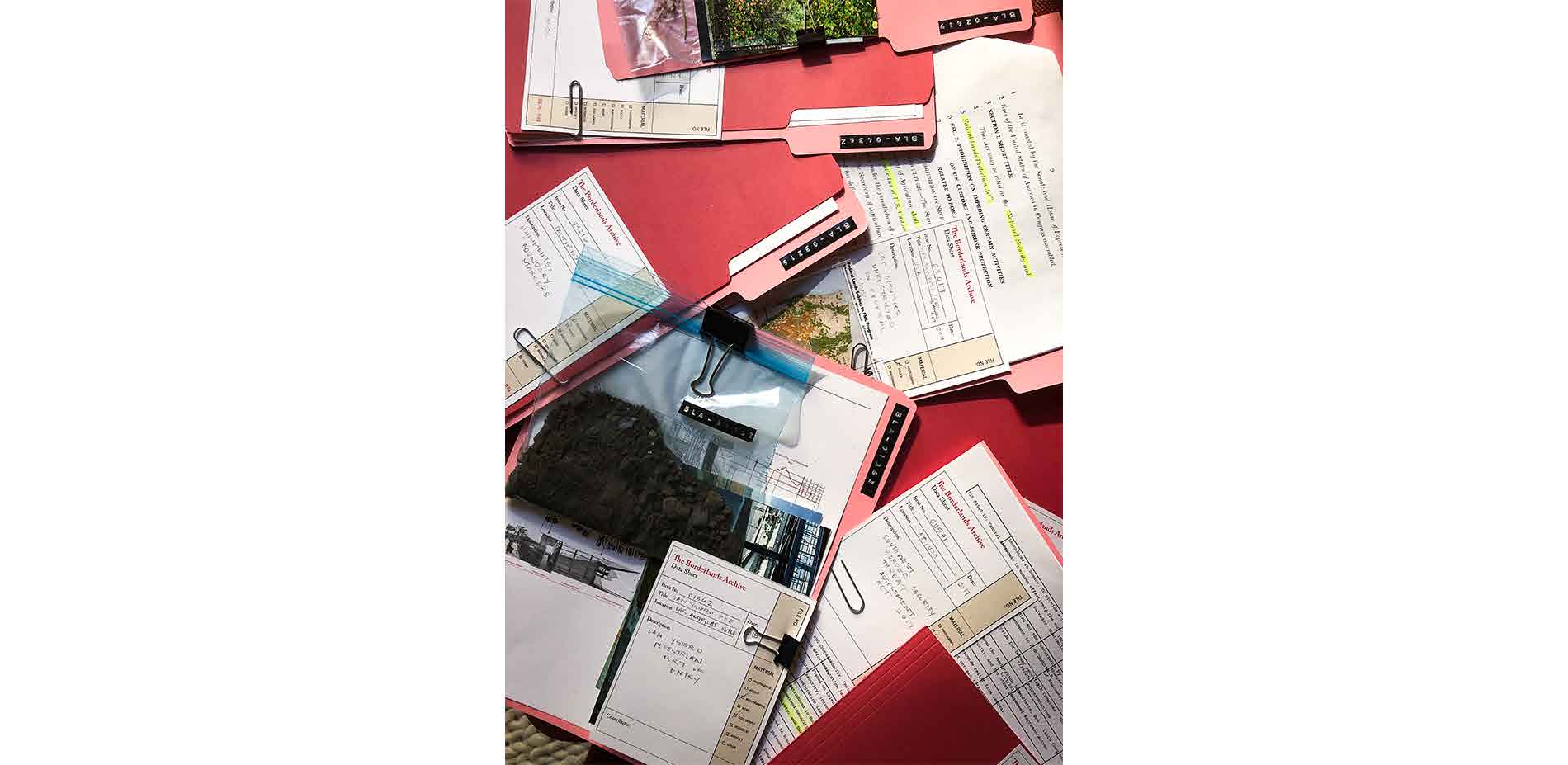
Territorial boundaries and borders are not passive, they are productive. The Borderlands Archive traces connection across territorial divide by collecting photographs, artifacts, artworks, histories, data and publications about the borderlands. It is a research project, an experiment in representation and an artistic gesture towards a collective knowledge about a contested space between two countries. This ongoing project traces a non-linear history across an ancestral landscape and explores ideas about place, territory, and border as urbanism in a bi-national context. The work employs the archive as a tool for capturing moving relationships in this complex built and natural environment, and invites others to contribute to the narrative. The objective of this research is to trump existing notions about fixed borders by reconceptualizing borders as a vast space in constant flux: the borderlands. Conceptualizing borders in this way prioritizes the spatiality of borders, which for a designer like me, is a profoundly important means for understanding the complex productivity of borders and further defining edge conditions.
Through this piece, I spotlight BLA File No. 01362, a repository for San Ysidro’s western pedestrian entry, or ‘PedWest.’ Here, in just a half mile, you can learn so much about how borders as monuments modulate the logistics of space. Turning to the surrounding landscape, I specifically examine land use practices established by the state to assert control extensively across territory. While the physical border serves as a monument of national-security, power, and otherness. The surrounding landscape conditions become a less overt but equally robust manifestation of state control. Both of these measures of control—border and exclusionary zoning—work in tandem for one reason: to restrict migration. In the case of ‘PedWest’ human migration cannot be avoided, but it can be controlled. Below I list the land-use practices we see at the PedWest crossing and how the idea of border urbanism is embodied in this specific location.
EDGE CONDITIONS: A case study on PedWest
File No. 01362
File Name: ‘PedWest’ Pedestrian POE
Location: 32.54264, -117.03641
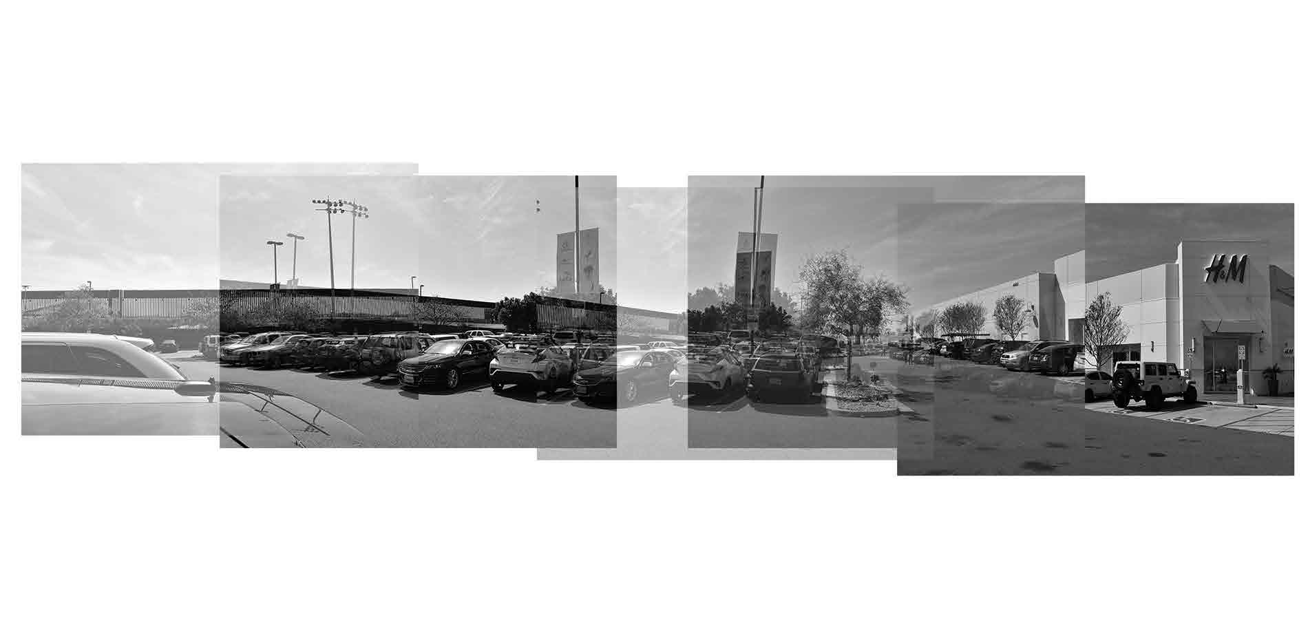
Border Malls:
The PedWest Port of Entry begins and ends at a mall. This uncovers a flow that the United States permits to move freely through across territorial boundaries: capital flow. North of the border, the Las America’s Outlets take the form of a Spanish Colonial architecture, with red roofs and stucco walls. And immediately after entering Mexico, Plaza Viva TIjuana hosts many U.S. fast-food chains. The transnational commercial gradient between San Diego and Tijuana eludes to a deep economic connection between both metropolises.
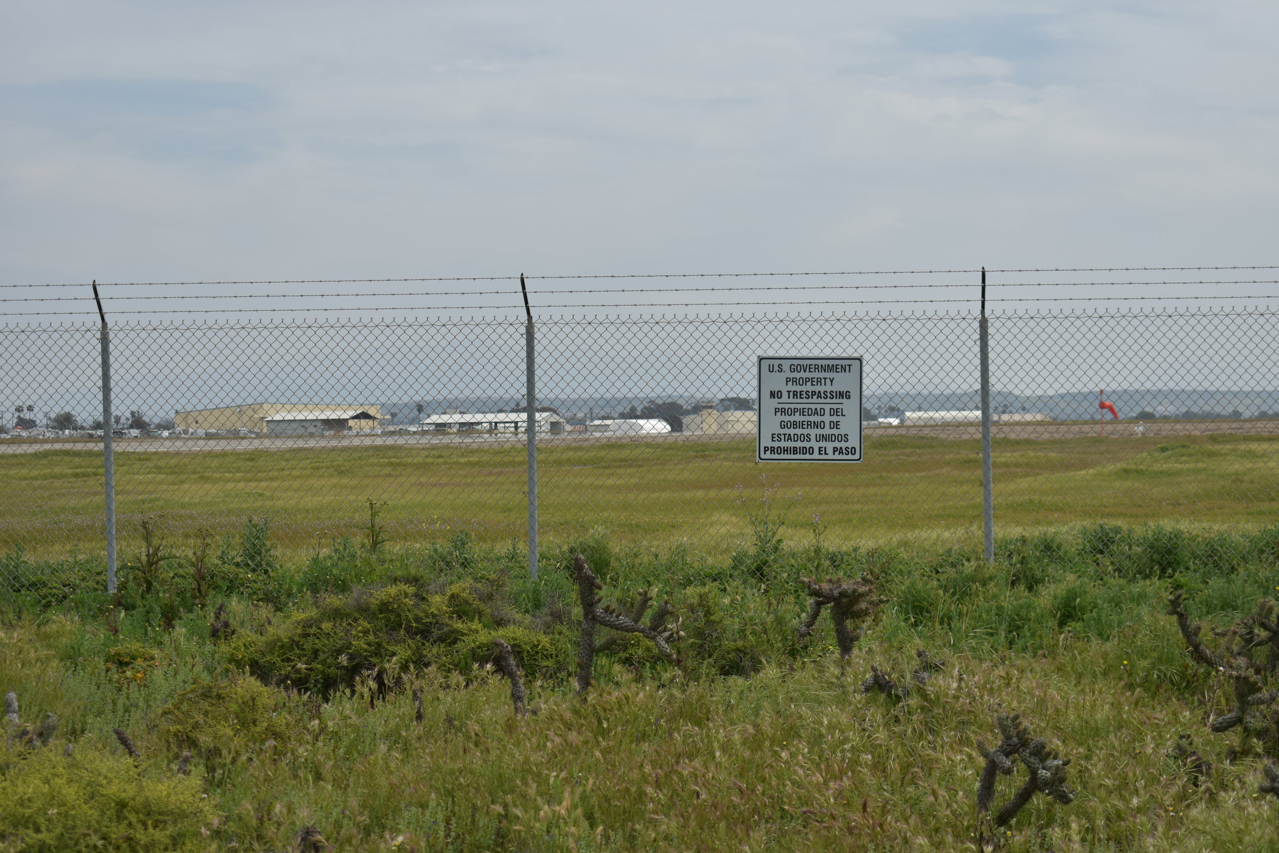
Homeland Security Zone:
On the northern side of the border, east of PedWest is a homeland security zone which manifest as a series of private parking lots. While entry is permitted to civilians, the large parking lot serves as a buffer-space for the border wall. This buffer space reinforces the arbitrary territorial line, the parking lot becomes a tool for thickening the border line.
The Federally protected Estuary:
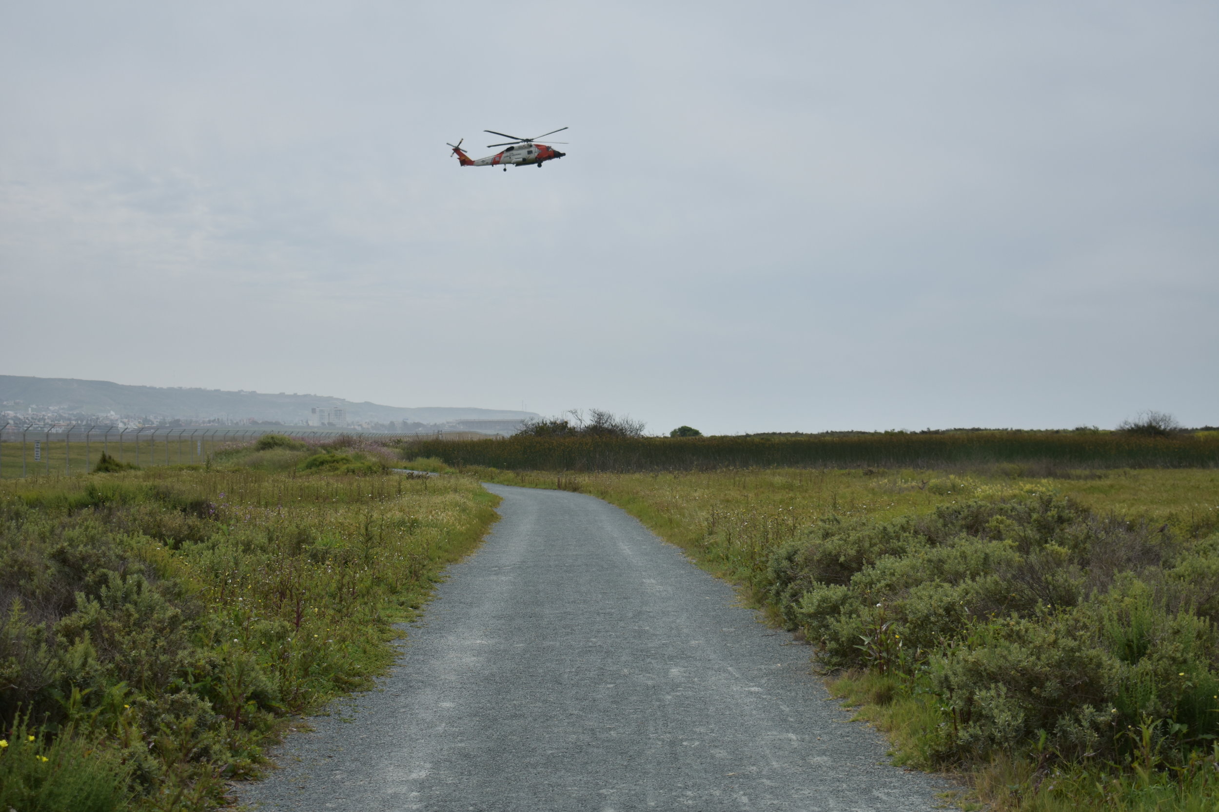
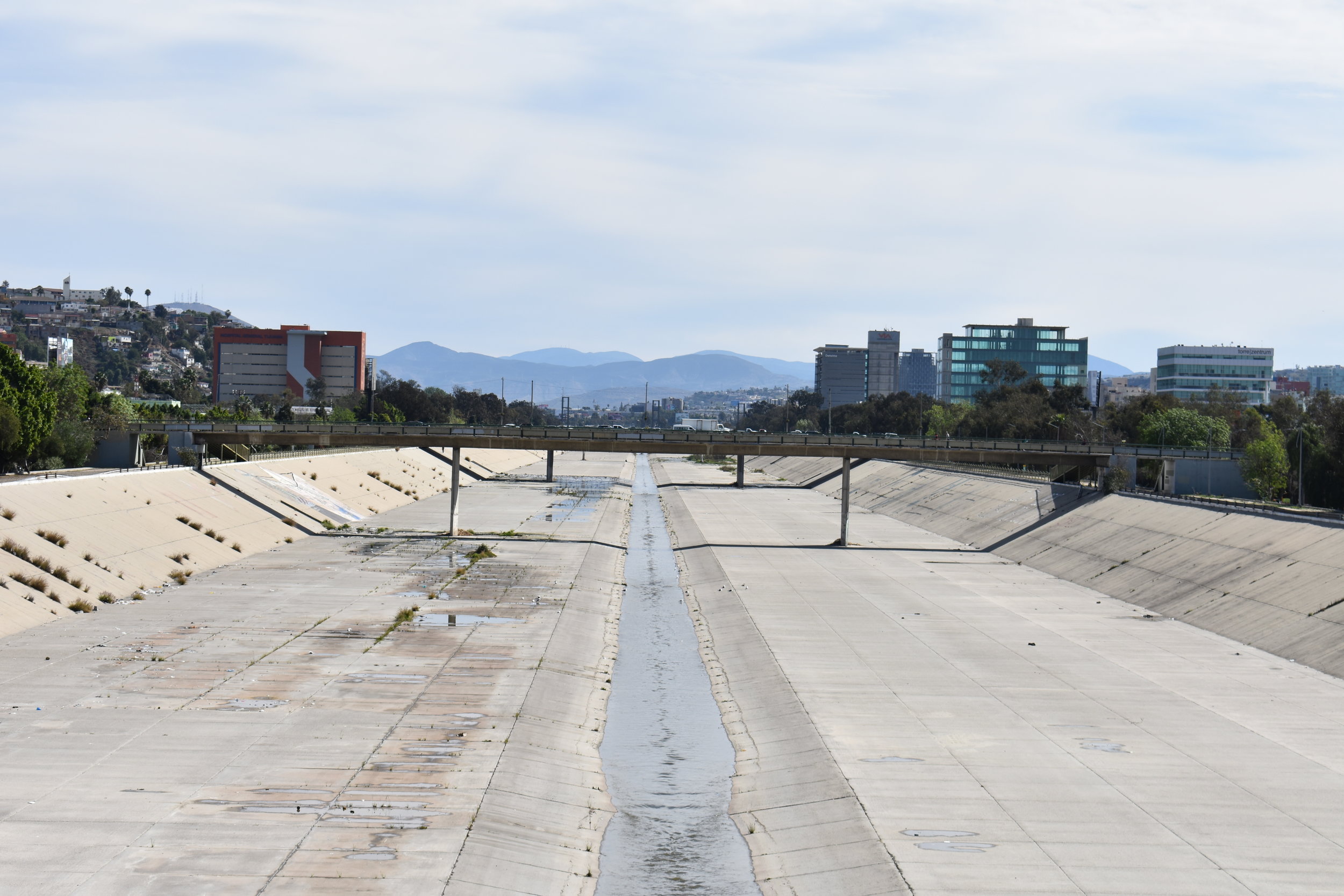
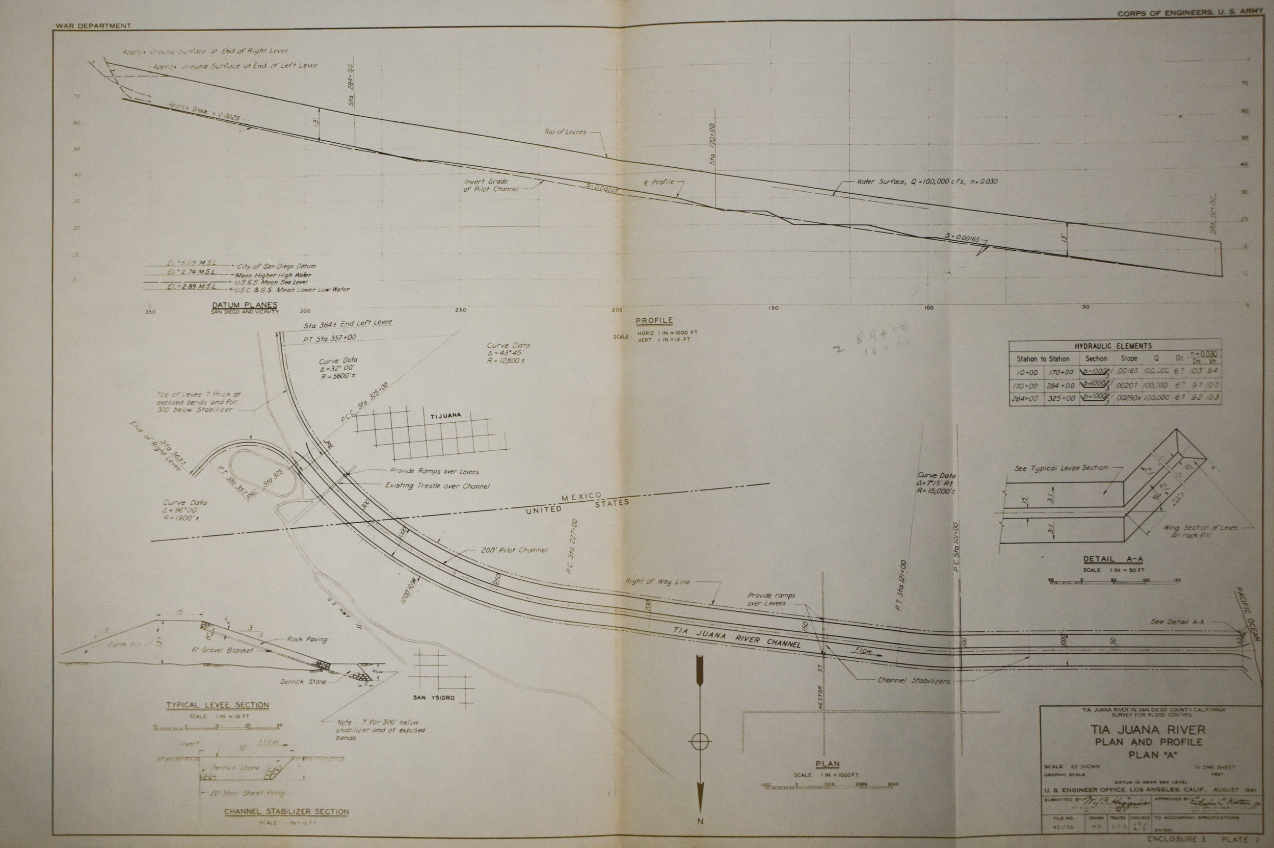
Just south, the Tijuana River can be viewed when walking across the elevated platform at PedWest.This is the location where in November 2018, a caravan of migrants attempted to illegally cross the border and were met with tear gas. In media photos, you see the elevated platform on the other side of the border fence. In Tijuana, the channelized river meets the border and overflows into the protected estuary. This is a fascinating site of overlapping federal land uses, it is the location of Tijuana river National Estuarine Research Reserve, Tijuana Slough National Wildlife Refuge and Border Field State Park (a former state-defense site). It is a site with a long history of infrastructural investment, and land use control. The estuary is 2,500 acres and reaches all the way to the Pacific Ocean, the site is buffered by a Naval Base where aerial military training is incessantly practiced.
The Borderlands Archive is an attempt at understanding and cataloging the spatial conditions negotiated by borders. The PedWest file is a collection of photographs that attempt to capture these spatial conditions. The project is intended to challenge our concept of borders by eluding to the ways border have manifested in the surrounding landscape: the borderlands. This project is ongoing and seeking contributions. For more, please visit www.borderlandsarchive.org