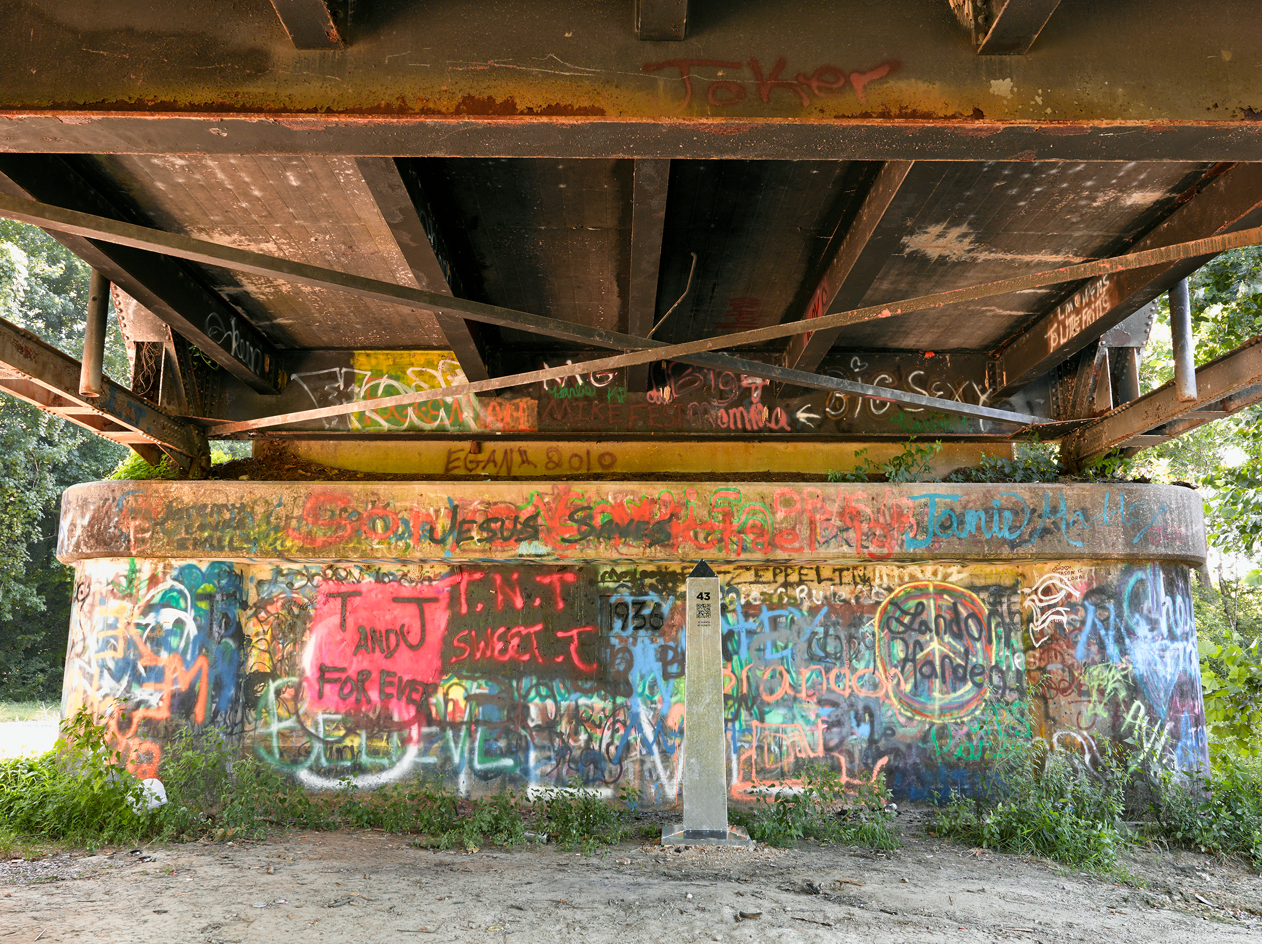
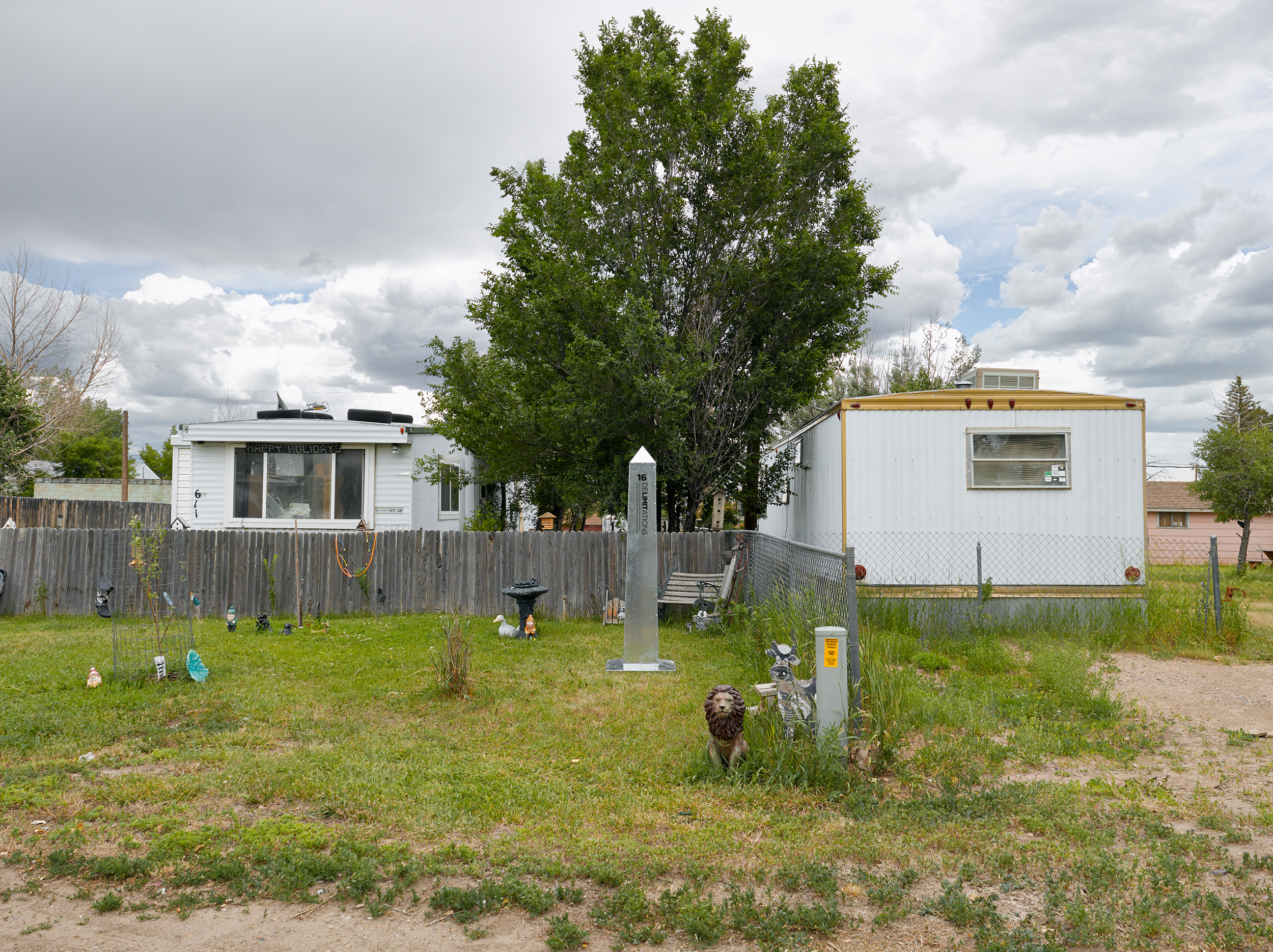
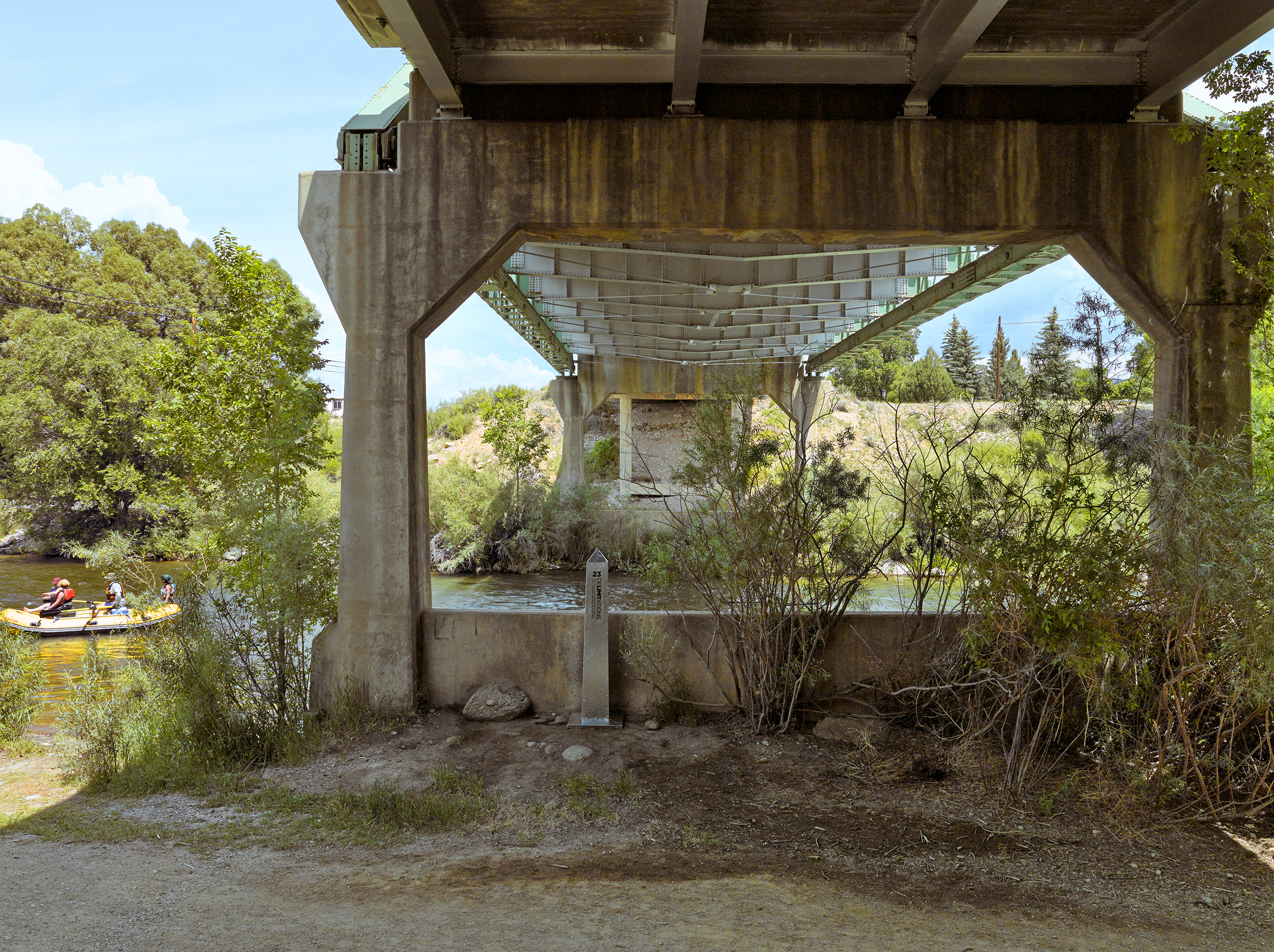
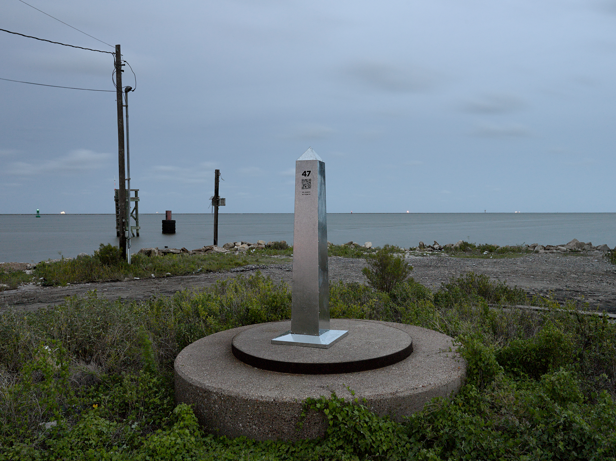
DeLIMITations (2014) is a 2,300-mile site-specific intervention by artists Marcos Ramírez ERRE (Mexico) and David Taylor (United States) that physically delineated the never before surveyed 1821 boundary between Mexico and the United States as described in the Adams-Onís Treaty of 1819.
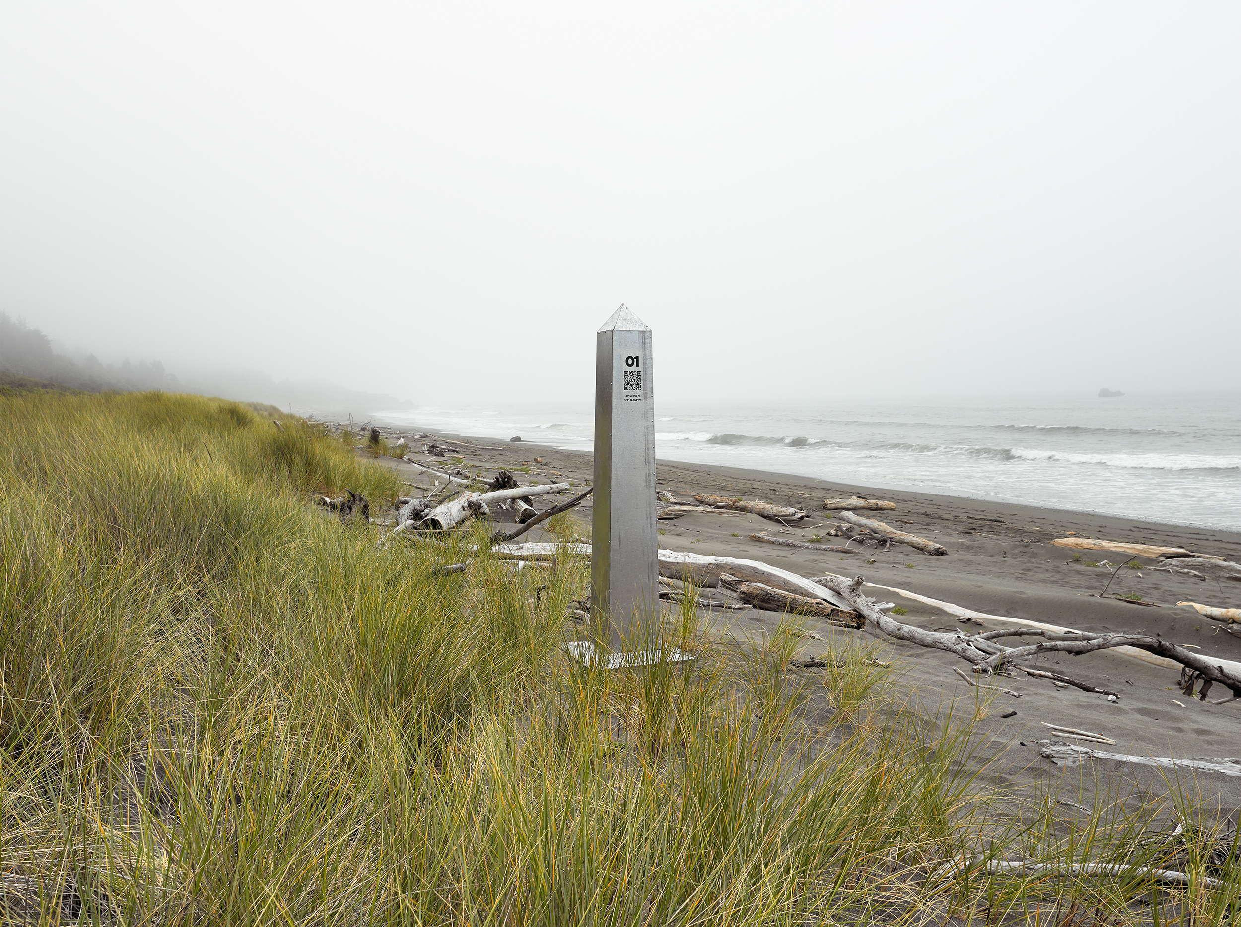
Using historic maps and the treaty text as their guide, the bi-national team placed 47 steel obelisks along the course of the short-lived border which extends from the Pacific Coast just south of Brookings, Oregon, to the mouth of the Sabine River near Port Arthur, Texas. The obelisks that ERRE and Taylor fabricated for DeLIMITations have the same profile and dimensions as the cast-iron obelisks that mark the contemporary U.S.-Mexico Border, which were installed by the international Boundary Commission between 1891 and 1895 and were documented in their entirety by Taylor for the project Monuments: 276 Views of the United States - Mexico Border.
The project questions the idealized narratives embedded in Manifest Destiny (which are recounted on numerous “official” monuments). The notion that, by divine right, the West was the inevitable domain of an expanding United States. The self-validating ideological assertions of Manifest Destiny obscure less-flattering ways of understanding westward expansion—genocide and imperial aggression. The Monroe Doctrine (1823), Indian Removal Act (1830), and the Mexican-American War (1846-1848) continue to reverberate in the contemporary west. We see their legacy unfold in the form of migrant caravans, border wall construction, and immigration raids. The events that we see along our contemporary border are inextricably linked to that history.
The contemporary border between Mexico and the United States cannot be understood without first recognizing that there was another border that preceded it. While some fraction of Americans acknowledge that a portion of the American Southwest was once part of Mexico, far fewer realize that Mexico had encompassed all of present-day Arizona, California, Nevada, New Mexico, Texas and Utah along with about half of Colorado and small portions of Kansas, Oklahoma, and Wyoming. Conversely, Mexicans are acutely aware that more than half of Mexico’s territory was forcibly annexed by the United States.
As a monument, DeLIMITations temporarily revealed the expansive territory that Mexico ceded to the United States in the wake of the Mexican-American War. The project is a response to a particular portrayal of history—its omissions, biases, and blind spots. Thinking through that thread, monuments can function as static assertions that amplify a particular vantage point and simplify history. At the same time, as we have seen with Confederate monuments throughout the United States, they can be challenged and reactivated. Their authority can be disrupted and, in the case of the George Floyd memorial that was projected on to the now-removed Robert E. Lee statue in Richmond, monuments can be reinscribed and disrupted through interventions that force audiences to re-evaluate their meanings. DeLIMITations, and other similar projects, suggest that iterative monuments are continually subject to revision.
While predominantly framed by debates around national security, sovereignty, and legal versus illegal immigration, the hardening of the contemporary U.S.-Mexico border operates as the ultimate assimilation of the Southwest into the United States and can be viewed as a closing act of the Frontier narrative. However, the history of borders as we understand them today is relatively short, spanning only a few hundred years. While the impulse is to perceive borders as permanent, there is little to support that myth over the long arc of history. The provisional nature of DeLIMITations is meant to underline that reality. The obelisks placed along the historic border will inevitably be displaced over time, and that boundary will once again disappear. Borders shift and change frequently and the American West remains a territory in transition—one that we may not recognize one-hundred years into the future.
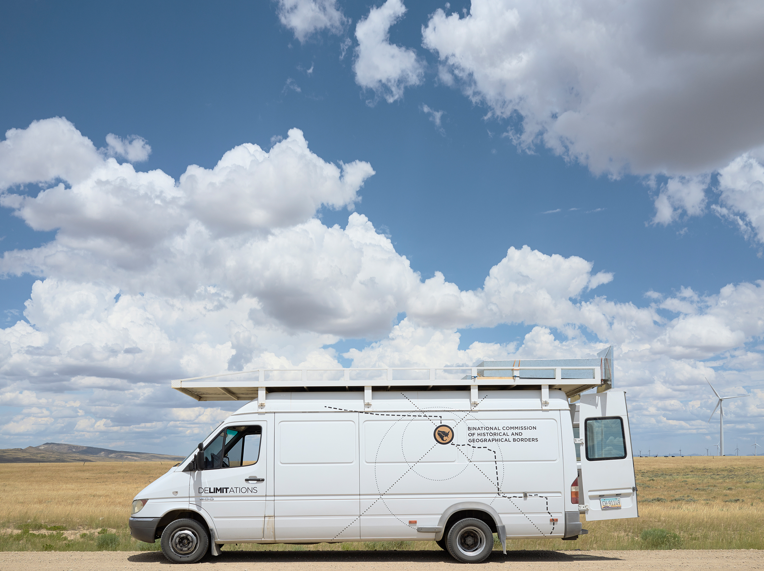
Learn more about DeLIMITations by visiting the project website and download the project broadsheet, “When ‘Forever’ Lasted 27 Years/Cuando ‘Para Siempre’ Duró 27 Años,” which includes the Adams-Onís Treaty text description of the 1821 boundary along with artist commentary.
This essay in the “Changing Monument Landscape” series was commissioned as part of the launch for the National Monument Audit, produced by Monument Lab in partnership with The Andrew W. Mellon Foundation. For more on the Audit, visit monumentlab.com/audit.